
 For surveyors, civil engineers and contractors
Free point cloud and surveying software From survey to volume, the same day.
Open the point cloud and get terrain, contours, alignments, sections and volumes. Your AI runs the whole process while you check the numbers you'll sign.
Free account · No card · Delivered on launch day
- Free to edit
- 37 tools for your AI
- Español · English · עברית
Whether or not you master the software, you get the volume.
MCP is an open standard that connects your AI to the app's real tools, like a universal plug. You talk normally; your assistant picks the tool, uses it and leaves you a result ready to edit.
How much earth do we need to move to level this lot?
Civil·Uses the app's tools
Waiting for instructions from your AI…
- open_file
- classify_ground
- create_surface
- compute_volume
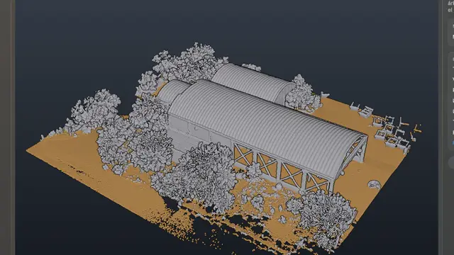
Cut 1,240 m³ · fill 860 m³.
Ask in your own words and your AI runs the technical process. You get the number and see where it came from.
Surfaces, contours, orthophotos and exports with your exact parameters, in one instruction.
The connection is free and you set it up once. You pay for your AI with your own account; everything it does stays editable in the app.
The client wants the volume today. Your software, three days.
One instruction. The whole process.
Your assistant uses Civil's 37 tools: opens the file, classifies ground, builds the surface and contours, draws the alignment, cuts sections and computes volumes. You validate.
What it does in the app, with the connector's real tools:
open_fileALMACEN.rcsclassify_ground3.2 M pointscreate_surface0.5 mcreate_contours0.25 mcreate_alignmentAccesscreate_sectionsevery 20 mcompute_volumecut / fill
Before
- Clean and classify the cloud
- Build surface and contours
- Draw alignment and sections
- Reconcile volumes by hand
With Civil + your AI
- Describe the deliverable
- Check the numbers
- Deliver first
You stay in charge: everything stays editable, and if you don't want AI, everything works by hand.
What you'll be able to do
Engineering, without waiting on software
Tens of millions of points
Open RCS, RCP, LAS, E57 and more, and move through them smoothly.From ground to project
Surfaces, contours, alignments, profiles, sections, orthophotos and volumes.Continue in CAD
Send your drawing to CAD Meier or export it for your team.What everyone asks before saying “I want it”
What is Civil Meier Studio?
It's a Mac program that opens point clouds with tens of millions of points (RCS, RCP, LAS, E57, PLY, PTS, XYZ and more) and produces surfaces, contours, alignments, profiles, sections, orthophotos and volumes. It connects over MCP to your AI with 37 tools and sends your drawings to CAD Meier.
How is a cut and fill volume calculated?
Two surfaces are compared — the natural ground and the design — to measure the material in excess (cut) and the material missing (fill). Civil Meier Studio calculates it with the surface it builds from your point cloud and keeps every step in the project for you to review.
What files does it open?
RCS, RCP, LAS, E57, PLY, PTS, XYZ, TXT, CSV and DXF, among others.
Can I trust the AI's volumes?
The AI doesn't make up numbers: it uses the same app calculations you would use by hand. Every step stays in the project for you to review.
Is it really free?
Yes. The account and every editing tool are free. You only pay if one day you want Iris to generate images, video, voice or music with Meier Credits, at the provider's cost. It's optional.
Do I need to know about AI?
No. If you already use Claude or another MCP-compatible assistant, you connect it in three steps and talk to it like a colleague. If not, the app works fully by hand.
What happens when I say “I want it”?
You create your free account and join the Civil launch list. On launch day you'll find it in your account and we'll let you know. People on the list get it first.
The bid that arrives first usually wins.
Save your spot for Civil for free and get it on launch day.
- Create your free accountThirty seconds. No card.
- You're on the Civil listYour spot is saved.
- It arrives on launch dayIn your account, before anyone else.
Free account · No card · Delivered on launch day